Fleet Visibility vs. Fleet Control: How GPS Tracking Turns Data Into Action
Many businesses start looking at GPS tracking because they want more control over their fleet. They want to know where vehicles are, why jobs are taking longer than expected, whether drivers are following routes, and how much time is being lost between stops. That is understandable. Fleet vehicles are expensive, fuel costs add up quickly, customers expect accurate service windows, and one late truck can affect the entire day.
But GPS tracking does not magically control a fleet by itself. What it gives you first is visibility. From there, the right system, settings, alerts, reports, and management habits can turn that visibility into real operational control. Understanding the difference matters because it helps businesses set realistic expectations and get more value from their tracking system.
Fleet Visibility Means Seeing What Is Actually Happening
Fleet visibility is the foundation. It means managers can see vehicle location, trip history, route activity, stops, driving events, and other fleet data from one platform. With Geotab fleet management software, businesses can monitor GPS vehicle tracking, driver behavior, engine data, route optimization, and engine health from a centralized system.
This replaces guesswork with data. Instead of calling drivers repeatedly to ask where they are, dispatchers can look at the map. Instead of relying on memory when a customer asks whether a crew arrived, managers can review location history. Instead of wondering why fuel costs are rising, the business can look at idling, routing, driving behavior, and vehicle use patterns.
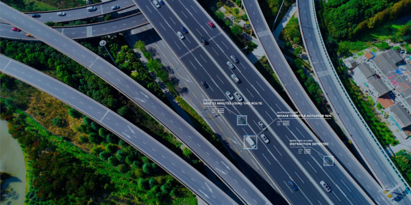
Visibility answers questions such as: Where are my vehicles? How long did they stay at a job? Which route did they take? Did the driver arrive on time? Was there an unplanned stop? Is a vehicle being used outside normal hours? Are drivers speeding, idling, or braking harshly? These answers are valuable because they show what is happening in the field without waiting for manual updates.
Fleet Control Means Turning Data Into Action
Fleet control starts after visibility. It is the process of using tracking data to make better decisions, set expectations, automate alerts, coach drivers, improve routes, reduce waste, and protect vehicles or assets. A map alone gives you awareness. A configured system with rules, alerts, reports, and workflows gives you control.
For example, seeing that a truck is idling for long periods is visibility. Creating an idling alert, reviewing weekly idling reports, coaching drivers, and measuring improvement is control. Geotab’s support documentation shows how fleets can create custom rules for idling within specific zones, which is a good example of turning raw vehicle activity into a management process.
This is where many fleets see the real value. GPS tracking is not just about knowing where a vehicle is. It is about creating a feedback loop between field activity and office decisions. Managers can spot problems faster, respond with better information, and build processes that make the fleet more consistent over time.
The Map Is Only the Beginning
A common mistake is thinking GPS tracking is just dots moving on a map. Location is important, but it is only one part of fleet management. Modern telematics systems can connect location data with driver behavior, engine health, fuel use, route performance, alerts, inspections, and compliance workflows.
That broader view helps businesses move from “Where is the truck?” to “What is the truck doing, how is it being driven, is it being used efficiently, and what should we do next?” Geotab’s platform includes driver behavior management, engine data reporting, GPS vehicle tracking, route optimization, and maintenance tools. Together, these features help businesses understand both vehicle movement and vehicle performance.
For example, two drivers may complete the same route, but one may use more fuel because of excessive idling, harsh acceleration, or inefficient stops. Without visibility, both routes may look the same because both jobs were completed. With telematics data, managers can see the difference and take action.
Alerts Help Managers Respond Faster
Fleet visibility becomes more useful when managers do not have to manually watch the system all day. Rules and alerts help turn important events into automatic notifications. Geotab explains how fleets can use custom rules for events such as speed, harsh braking, acceleration, and cornering to manage by exception instead of trying to monitor every vehicle manually.
This is where GPS tracking begins to feel more like control. A manager does not need to wait until the end of the week to discover a pattern. If a vehicle leaves a yard after hours, enters a restricted area, exceeds a speed threshold, or triggers another rule, the right people can be notified.
However, alerts should be planned carefully. Too many alerts can create noise. Too few alerts can allow problems to continue unnoticed. The goal is not to notify managers about everything. The goal is to identify the events that matter most to safety, cost, customer service, compliance, and asset protection.
Geofencing Adds Structure to Location Data
Geofencing is one of the clearest examples of turning visibility into control. A geofence is a virtual boundary around a location such as a yard, warehouse, customer site, job site, restricted area, or service zone. Geotab explains that geofencing can trigger alerts or actions when vehicles enter or exit defined areas.
For many businesses, this is more useful than simply watching vehicles on a map. A landscaping company can know when crews arrive at a property. A construction company can monitor equipment movement between yards and job sites. A delivery company can confirm arrival and departure times. A service fleet can review how long vehicles spent at each customer location.
Geofencing can also support accountability. If a vehicle is supposed to remain in a service area, managers can receive alerts when it leaves. If equipment should not move after hours, geofencing can help identify unauthorized movement. This does not physically stop the vehicle, but it gives the business faster awareness and a better record of what happened.
GPS Tracking Supports Safer Driving Programs
Fleet control is also about reducing risk. Speeding, harsh braking, aggressive acceleration, and poor driving habits can increase safety concerns, fuel use, wear and tear, and liability exposure. According to NHTSA, 11,288 people died in speeding-related traffic deaths in 2024, which shows why speeding remains an important safety issue for any organization operating vehicles on public roads.
GPS tracking can help businesses address these risks with driver behavior data, alerts, scorecards, and coaching. The purpose should not be to create a “gotcha” culture. The purpose should be to make expectations clear, identify risky patterns, and help drivers improve before a serious incident happens.
The best safety programs use telematics data consistently and fairly. Drivers should know what is being measured, why it matters, and how the company will use the information. When managers use the data for coaching, recognition, and prevention, GPS tracking becomes a tool for safer operations rather than just a monitoring system.
Better Control Over Routes, Stops, and Schedules
For many fleets, lost time is one of the biggest hidden costs. A few extra minutes at each stop, repeated detours, long idle periods, or inefficient routing can add up across the day. GPS tracking gives businesses the ability to compare planned routes with actual activity and identify where schedules break down.
Geotab’s fleet routing and dispatching software helps fleets plan routes, organize stops and waypoints, and improve route efficiency. Geotab’s Routing and Optimization guide also explains that the route module can use business objectives such as minimizing drive distance or increasing on-time arrivals when creating daily routes.
Dispatchers also benefit from real-time visibility. When an urgent job comes in, they can find the nearest available vehicle instead of calling multiple drivers. When a delay happens, they can adjust expectations with better information. When a route repeatedly causes problems, managers can review the data and improve the plan.
Maintenance Control Starts With Vehicle Data
Fleet visibility is not limited to location. Vehicle health data can help businesses move from reactive maintenance to more proactive planning. Geotab’s fleet maintenance solutions help fleets manage work orders, maintenance schedules, vehicle issue notifications, remote diagnostics, and important fault prioritization.
This is important because downtime affects more than the repair invoice. A vehicle that is unexpectedly out of service can delay jobs, create overtime, require rentals, frustrate customers, and put pressure on other drivers. GPS tracking and telematics data can help managers monitor engine alerts, odometer readings, engine hours, and maintenance reminders so repairs can be planned more intelligently.
Again, the difference between visibility and control is action. Seeing an engine fault code is visibility. Creating a maintenance workflow, assigning responsibility, scheduling the repair, and tracking completion is control.
Compliance Support Is Not the Same as Automatic Compliance
For regulated fleets, GPS tracking and telematics can also support compliance. FMCSA explains that an electronic logging device synchronizes with a vehicle engine to automatically record driving time, making Hours of Service recordkeeping easier and more accurate. FMCSA also notes that an ELD automatically records data elements such as date, time, location information, engine hours, and vehicle miles.
However, technology does not replace responsibility. A compliant system still needs proper setup, driver training, accurate records, and regular review. The system can make compliance easier, but the business still needs policies and accountability. GPS tracking gives fleets the data and tools to manage compliance more efficiently, but managers still need to use those tools correctly.
Privacy and Trust Still Matter
Fleet control should not mean unlimited surveillance. Businesses should be clear with employees about what is tracked, when tracking is active, why the data is collected, and how it will be used. Trust matters because drivers are more likely to accept GPS tracking when they understand that it supports safety, efficiency, payroll accuracy, customer service, maintenance, and asset protection.
Geotab’s Personal Mode allows drivers and fleet managers to temporarily hide GPS-based location features such as position, trips, and speed profiles in MyGeotab, while non-GPS data such as engine and accelerometer data can remain visible. This can help businesses create tracking policies that fit their operations, especially when vehicles may be used in both business and personal contexts.
A good GPS tracking policy should explain the purpose of tracking, who can access the data, how long data is reviewed, what events trigger alerts, and how driver coaching will be handled. Control works best when it is transparent and fair.
What GPS Tracking Actually Gives You
GPS tracking gives you the information needed to manage a fleet more intelligently. It gives you visibility into vehicle location, trip history, driver behavior, stops, routes, idling, engine health, and fleet activity. It can help you find waste, respond faster, protect assets, improve customer communication, support compliance, and coach safer driving habits.
What it does not give you is automatic discipline, perfect routes, instant savings, or complete control without management involvement. The technology shows what is happening. The business still needs to decide what matters, set rules, train people, review reports, and act on the data.
That is the real value of GPS tracking. It gives fleet managers the visibility to see problems clearly and the tools to build better control over daily operations.
Build Better Fleet Control With GPS Tracking America
GPS Tracking America helps businesses implement Geotab-integrated GPS tracking solutions that support vehicle tracking, asset tracking, driver safety, route optimization, maintenance visibility, alerts, and practical fleet management. Whether your business wants better visibility, stronger accountability, improved dispatching, or more useful fleet data, our team can help you choose the right Geotab GO tracking device, configure the system, and turn your fleet information into action. To learn more about building better visibility and control across your fleet, contact us today.
Frequently Asked Questions
What is the difference between fleet visibility and fleet control?
Fleet visibility means being able to see what is happening across your fleet, such as vehicle locations, trip history, stops, idling, routes, and driver behavior. Fleet control means using that information to make decisions, create alerts, improve workflows, coach drivers, and manage operations more effectively.
Does GPS tracking give a business full control over its fleet?
GPS tracking gives businesses the data and tools needed to improve control, but it does not manage the fleet automatically. Managers still need to set rules, review reports, train employees, respond to alerts, and use the information to guide daily decisions.
What does fleet visibility include?
Fleet visibility can include real-time vehicle location, route history, stop duration, driver behavior, engine health, idling activity, mileage, geofence activity, and vehicle use patterns.
Why is fleet visibility important?
Fleet visibility is important because it helps businesses understand what is happening in the field. It reduces guesswork, improves dispatching, supports customer updates, helps verify service, and gives managers better information for decision-making.
How does GPS tracking help fleet managers make better decisions?
GPS tracking helps fleet managers make better decisions by providing accurate data about vehicle activity, driver behavior, routes, stops, and maintenance needs. This helps managers identify problems, reduce waste, and improve daily operations.
Is GPS tracking only useful for large fleets?
No. GPS tracking can help small, medium, and large fleets. Even businesses with only a few vehicles can benefit from better visibility, improved dispatching, reduced fuel waste, and stronger accountability.
How does GPS tracking improve dispatching?
GPS tracking improves dispatching by showing where vehicles are in real time. Dispatchers can assign jobs to nearby drivers, respond faster to urgent requests, adjust routes, and provide customers with more accurate arrival updates.
What is geofencing in GPS tracking?
Geofencing is the use of virtual boundaries around specific locations such as yards, job sites, warehouses, customer locations, or restricted areas. When a vehicle enters or exits a geofence, the system can record the event or send an alert.
How does geofencing help with fleet control?
Geofencing helps with fleet control by showing when vehicles arrive at or leave important locations. It can help verify job-site activity, monitor after-hours movement, protect assets, and improve accountability.
Can GPS tracking help reduce fuel costs?
Yes. GPS tracking can help reduce fuel costs by identifying excessive idling, inefficient routes, unauthorized vehicle use, harsh driving, and unnecessary mileage. Managers can use this data to coach drivers and improve route planning.
How does GPS tracking support driver safety?
GPS tracking supports driver safety by monitoring behavior such as speeding, harsh braking, rapid acceleration, and aggressive cornering. This information can be used for driver coaching, safety policies, and performance improvement.
Does GPS tracking create a gotcha culture?
It can if used poorly, but it does not have to. GPS tracking works best when businesses are transparent with drivers, explain what is being tracked, and use the data for coaching, safety, recognition, and operational improvement.
Can GPS tracking help with maintenance?
Yes. GPS tracking and telematics can help with maintenance by tracking mileage, engine hours, diagnostic alerts, fault codes, and service schedules. This helps businesses plan repairs before small issues become major breakdowns.
What is the role of alerts in fleet management?
Alerts help fleet managers respond faster to important events such as speeding, long idling, after-hours movement, geofence activity, unauthorized use, or vehicle issues. Alerts turn fleet data into timely action.
Can GPS tracking help prove that a service was completed?
Yes. GPS tracking can show when a vehicle arrived at a customer location, how long it stayed, and when it left. This can help verify service activity, support billing accuracy, and resolve customer disputes.
How does GPS tracking help with route optimization?
GPS tracking helps with route optimization by showing actual route activity, stop patterns, delays, traffic-related issues, and inefficient driving routes. Managers can use this information to improve future route planning.
Is GPS tracking useful for asset tracking?
Yes. GPS tracking can be used for vehicles, trailers, equipment, tools, containers, and other mobile assets. Asset tracking helps businesses locate valuable equipment, reduce loss, and monitor movement between sites.
Can GPS tracking help with compliance?
Yes. For regulated fleets, GPS tracking and telematics can support compliance by helping with driver logs, Hours of Service records, inspections, vehicle data, and reporting. However, businesses still need proper procedures and employee training.
What should businesses tell employees about GPS tracking?
Businesses should explain why GPS tracking is being used, what data is collected, who can access it, when tracking is active, and how the information will be used. Clear communication helps build trust and reduce concerns.
What does GPS tracking actually give a business?
GPS tracking gives a business better visibility into fleet activity and the tools to improve control. It helps managers see what is happening, identify problems, reduce waste, improve safety, support maintenance, and make more informed decisions.