Geotab Live Google Mapping and Flexible Map Types
Geotab provides near-real-time fleet mapping through MyGeotab, helping authorized users see the latest reported locations and operating status of connected vehicles and assets. Google Maps is the default map provider, with road, satellite, and Street View options that provide useful geographic context for fleet activity. MyGeotab also supports Mapbox and HERE road and satellite maps, allowing businesses to select a map provider suited to their location and operational needs. Fleet managers can search for vehicles and drivers, filter assets by group or status, and view information such as the current driver, location, speed, and whether an asset is driving, stopped, or not communicating. Because location updates depend on the tracking device and network connection, Geotab describes vehicle visibility as near-real-time rather than instantaneous.
Monitor Fleet Locations in Near Real Time
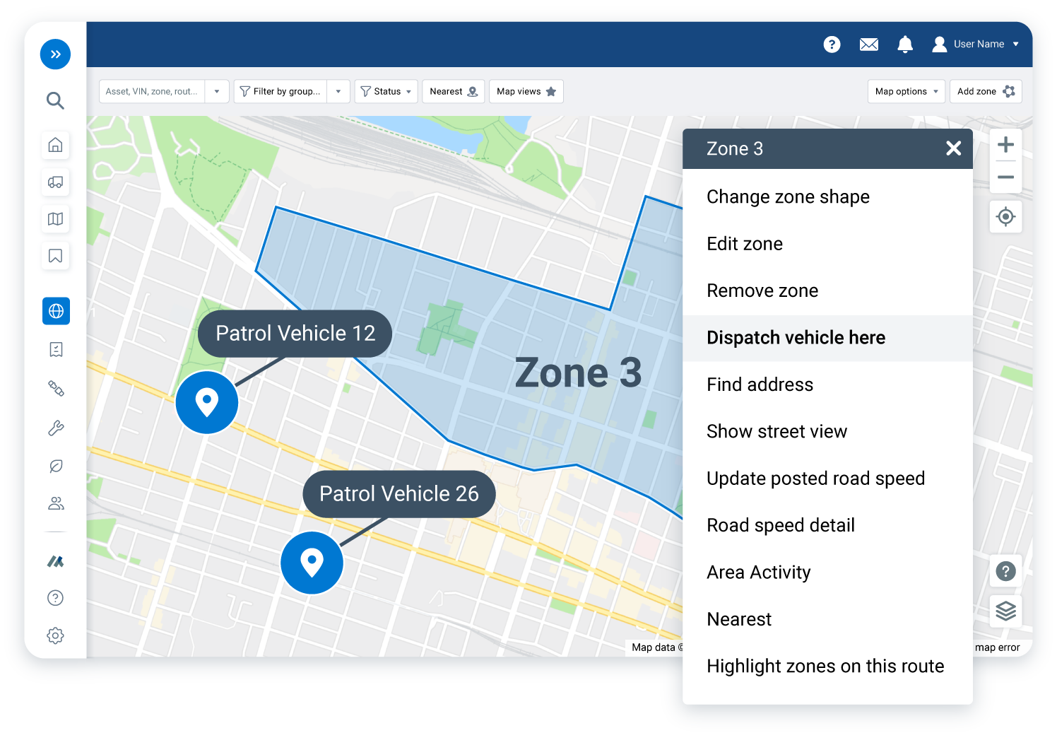
The MyGeotab Map gives fleet managers a centralized view of where connected vehicles and assets were last reported and what they are currently doing. Clearly differentiated map icons help users recognize moving vehicles, stops inside or outside company zones, non-communicating assets, active events, and charging electric vehicles. Managers can search for a specific vehicle or driver and filter the map by group, asset type, fuel type, powertrain, or operating status. This focused visibility can help dispatchers respond to customer requests, locate available vehicles, confirm arrivals, and make better-informed operational decisions without repeatedly contacting drivers for location updates.
Choose the Right Map Provider and View
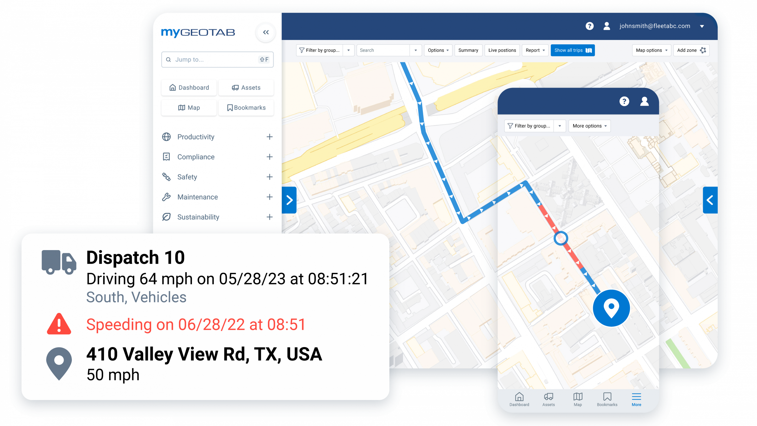
Different fleet activities require different geographic details. MyGeotab supports Google Maps, Mapbox, and HERE, with road and satellite map options available from each provider. Google Maps also provides Street View access and displays directional arrows on one-way roads. A road map can help dispatchers identify streets and routes clearly, while a satellite view can provide additional visual context around construction sites, parking areas, facilities, rural properties, and other locations that may be difficult to understand from street names alone. By selecting the most useful provider and map type, fleet teams can interpret vehicle locations more efficiently across different service areas and operating environments.
Customize Maps with Layers and Saved Views
MyGeotab allows users to control the information shown on the map through configurable layers for assets, labels, events, zones, weather, traffic, and routes. Fleet managers can reduce visual clutter by displaying only the information relevant to a particular task, such as traffic conditions for dispatching, zones for monitoring customer-site activity, or routes for comparing planned operations with vehicle movement. Frequently used combinations of locations, zoom levels, filters, and layers can be saved as map views and opened again without rebuilding the same layout. Geotab also supports custom web maps for specialized operational information, including municipal boundaries, infrastructure, customer locations, and other business-specific geographic data.

Improve Fleet Visibility with GPS Tracking America
Flexible mapping helps transform vehicle location data into practical information for dispatching, customer service, asset monitoring, route review, and daily fleet coordination. As a Geotab reseller, GPS Tracking America can help your business select an appropriate Geotab solution, configure MyGeotab map settings, organize vehicles and groups, create zones, and prepare useful map views for your operation. Contact us to learn how Geotab live vehicle mapping and multiple map types can give your team clearer, more efficient fleet visibility.
What is the MyGeotab Map?
The MyGeotab Map is a fleet management tool that displays the latest reported locations and operating status of connected vehicles and assets. It helps authorized users monitor fleet activity, locate drivers, review conditions, and coordinate dispatching.
Does Geotab use Google Maps?
Yes. Google Maps is the default map provider in MyGeotab. It provides road maps, satellite views, Street View access, touchscreen support, and arrows that indicate the direction of travel on one-way roads.
Does Geotab provide live GPS vehicle tracking?
Geotab provides near-real-time GPS tracking using location data transmitted by connected telematics devices. Update timing can vary based on the device, service plan, cellular coverage, network connectivity, and system configuration.
What other map types are available in MyGeotab?
MyGeotab supports standard road maps and satellite map views. Businesses may also use supported custom maps to display specialized geographic or operational information.
Which map providers does MyGeotab support?
MyGeotab supports Google Maps, Mapbox, and HERE. These options allow businesses to select a map provider that offers suitable detail and coverage for their operating area.
Can I change the map provider in MyGeotab?
Yes. Authorized users can manage supported map providers through MyGeotab settings and select a provider from the Map Layers menu. Available options can depend on database configuration and user permissions.
Is the satellite map in MyGeotab shown in real time?
No. Satellite view uses previously captured imagery as the map background. Connected vehicle positions can update in near real time, but the underlying satellite imagery is not a live video feed.
Can MyGeotab show Google Street View?
Yes. Google Street View is available for supported locations when Google Maps is selected. It can help users examine road access, entrances, loading areas, parking lots, and the surroundings of a destination.
What vehicle details can users see on the map?
Depending on the available data, users can view a vehicle’s latest reported location, assigned driver, speed, movement status, stop status, communication status, active events, and electric-vehicle charging status.
Can I search for individual vehicles and drivers?
Yes. Authorized users can search for a specific vehicle or driver by name. Driver locations depend on drivers being correctly assigned to or identified with their vehicles.
Can the MyGeotab Map be filtered?
Yes. Users can filter the map by vehicles, drivers, groups, asset types, fuel types, powertrains, and statuses such as driving, stopped, or not communicating.
What are MyGeotab map layers?
Map layers are configurable elements that users can display or hide. They can include assets, labels, events, zones, routes, weather, and traffic, allowing users to focus on the information relevant to their work.
Can traffic conditions be displayed in MyGeotab?
Yes. Users can enable the available traffic layer to add road-condition context to the map. Dispatchers can use this information when reviewing vehicle locations and coordinating assignments.
Does MyGeotab display weather information?
Yes. Users can enable an available weather layer to see weather information on the map. This can provide useful context for fleets operating in changing or potentially disruptive conditions.
Can Geotab geofences be shown on the map?
Yes. Geotab refers to geofences as zones. Users can display zones representing customer sites, depots, offices, job sites, service areas, restricted locations, and other important places.
Can planned routes be displayed on the map?
Yes. Users can enable the Routes layer and select routes to display in MyGeotab. This can help managers review operational plans and understand vehicle activity in relation to assigned routes.
Can users save their preferred map settings?
Yes. MyGeotab allows users to save map views containing selected locations, zoom levels, filters, sorting preferences, layers, and other options. A saved view can also be configured as the default map view.
Does Geotab support custom business maps?
Yes. Geotab supports custom web maps that combine fleet information with business-specific geographic data. Examples can include municipal boundaries, utility infrastructure, customer locations, private roads, and operational territories.
Why might a vehicle’s location not update?
Location updates can be delayed when a device loses cellular coverage, has not obtained a valid GPS position, is disconnected, or cannot communicate with the database. MyGeotab may continue showing the asset’s last reported location until new data is received.
How can GPS Tracking America help with Geotab mapping?
GPS Tracking America can help businesses choose an appropriate Geotab solution and configure map providers, asset groups, filters, zones, layers, and saved views. Contact us to learn how Geotab mapping can improve fleet visibility and dispatching.