Courier and Delivery
Courier and delivery fleets depend on speed, accuracy, and visibility. GPS Tracking America helps delivery businesses use Geotab-integrated fleet management solutions to monitor vehicles, improve dispatching, reduce delays, support driver safety, and make better decisions from real fleet data. Whether your operation handles local courier routes, parcel delivery, last-mile logistics, or scheduled business deliveries, Geotab solutions can help you manage vehicles, drivers, routes, and performance from one connected platform.
Improve Visibility Across Your Courier Fleet
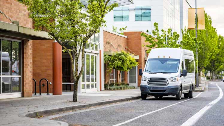
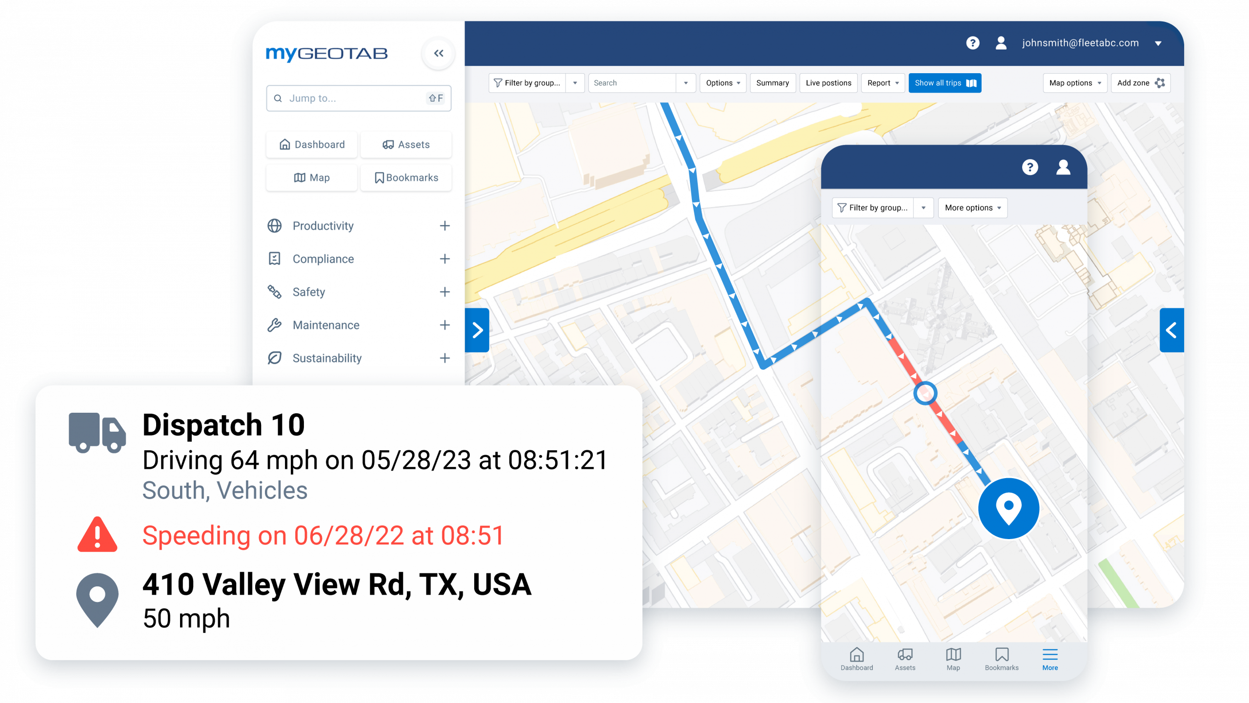
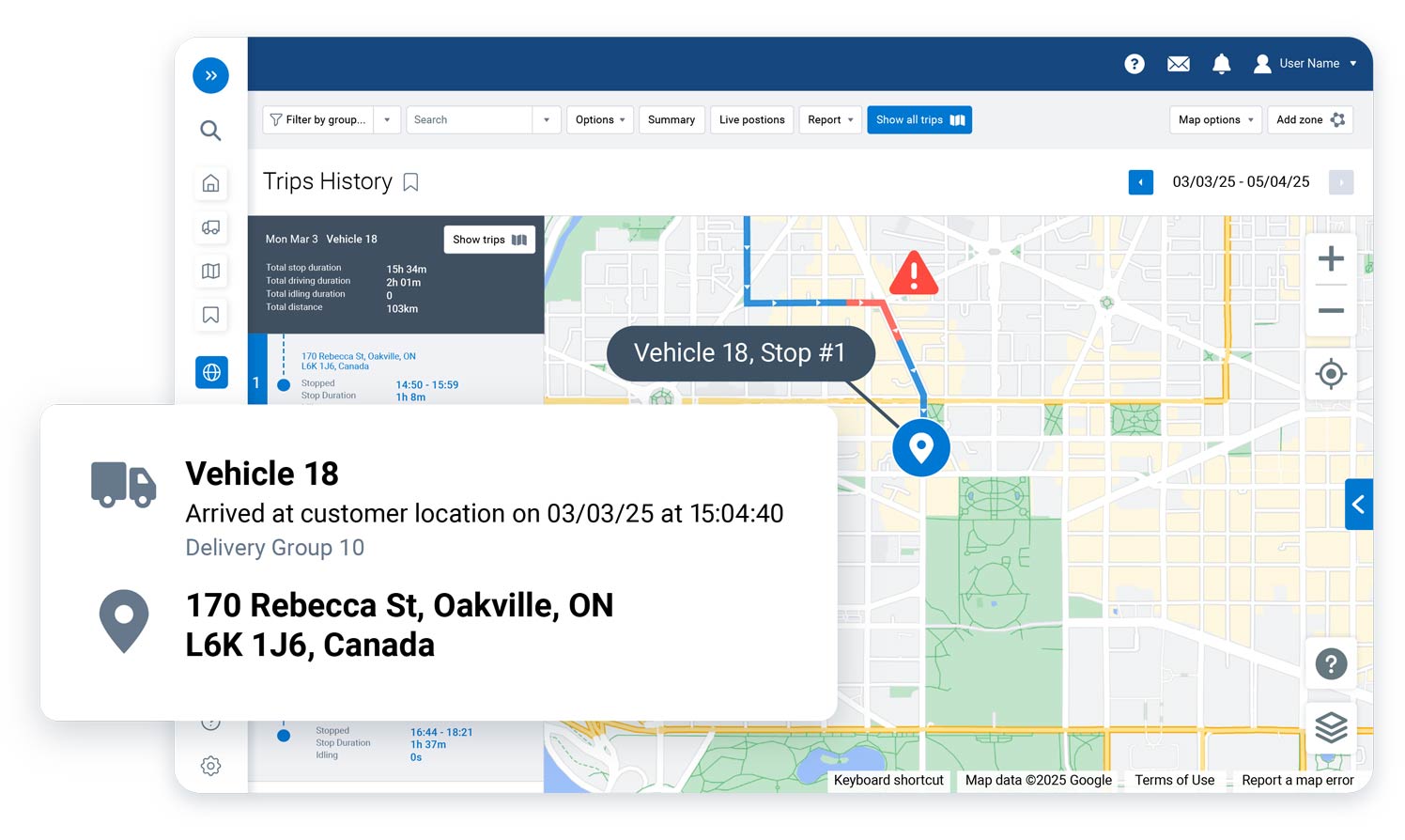
Knowing where your vehicles are is essential for fast, reliable delivery service. With Geotab GO devices and the MyGeotab platform, courier and delivery fleets can view vehicle location, trip history, speed, idling, mileage, and driver activity in one place. This gives managers a clearer picture of daily operations, helps dispatchers respond to schedule changes, and supports better communication with customers waiting for deliveries.
Optimize Routes for Faster, More Efficient Deliveries
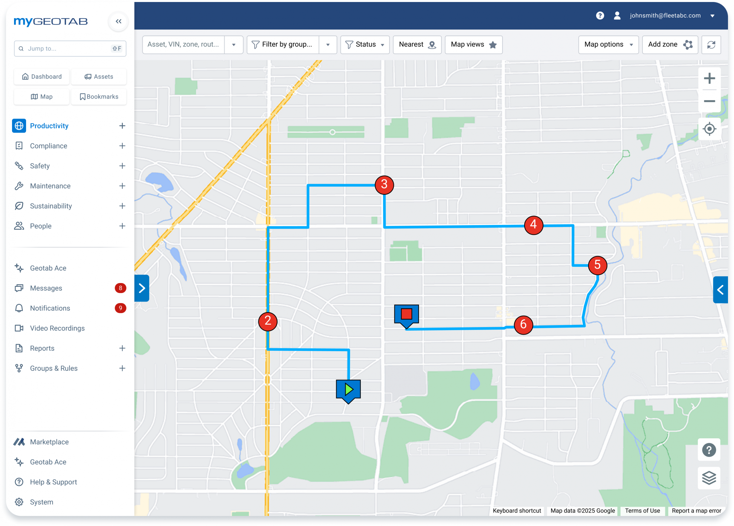
Courier and last-mile delivery fleets often deal with tight schedules, multiple stops, traffic delays, and last-minute changes. Geotab routing and dispatching tools can help teams plan efficient routes, organize stops and waypoints, compare planned versus actual activity, and make routing decisions based on real operational data. Better route planning can help reduce unnecessary mileage, improve delivery consistency, and make each driver’s day more productive.
Reduce Fuel Waste and Control Operating Costs
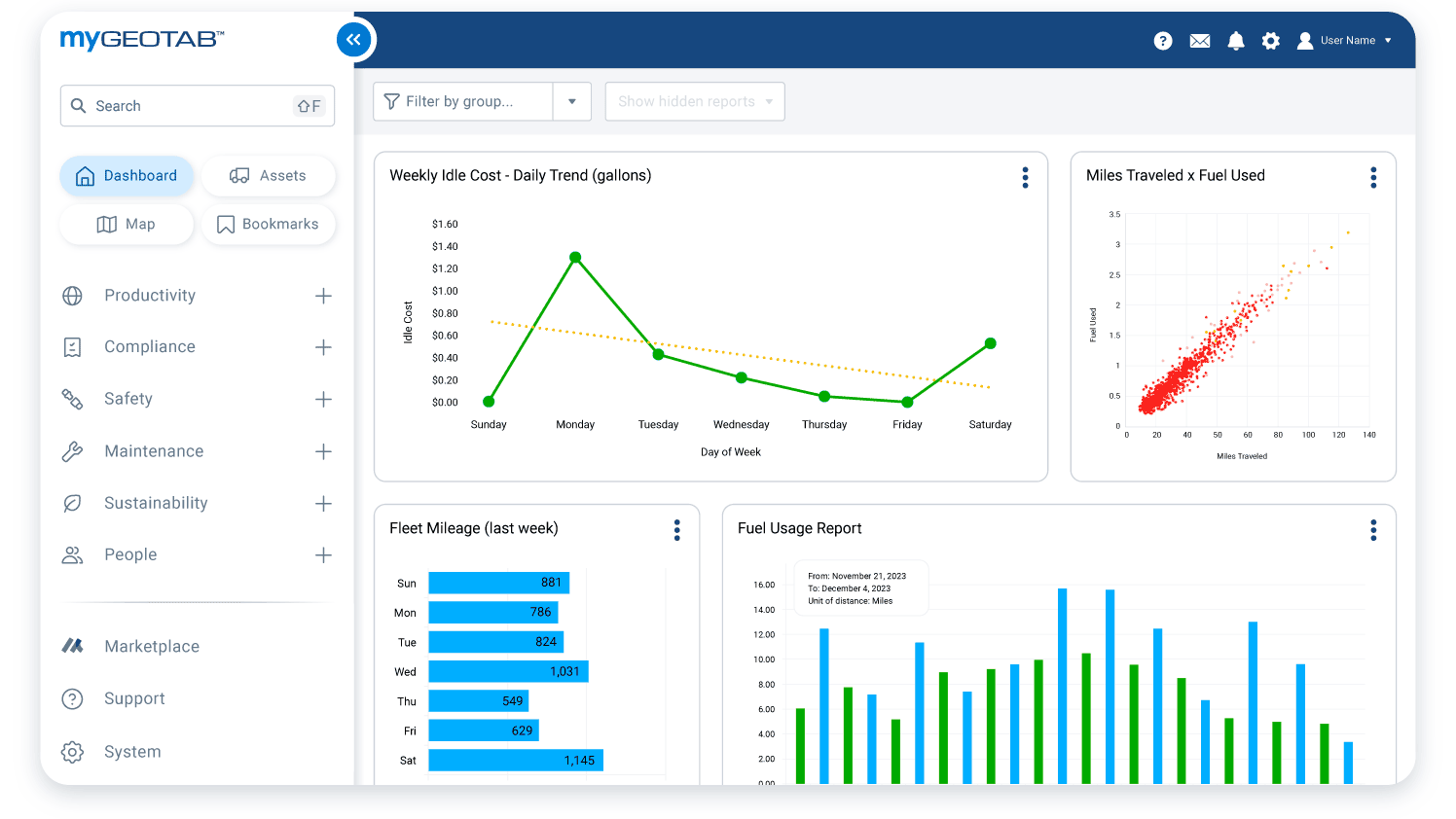
Fuel, idling, extra miles, and inefficient driving can quickly increase costs for delivery fleets. Geotab fleet reporting gives managers insight into idling trends, fuel use, route activity, stop counts, driving time, and vehicle performance. With this information, courier businesses can identify waste, coach better driving habits, adjust routes, and make cost-saving decisions based on measurable fleet data.
Protect Drivers in High-Stop Delivery Operations
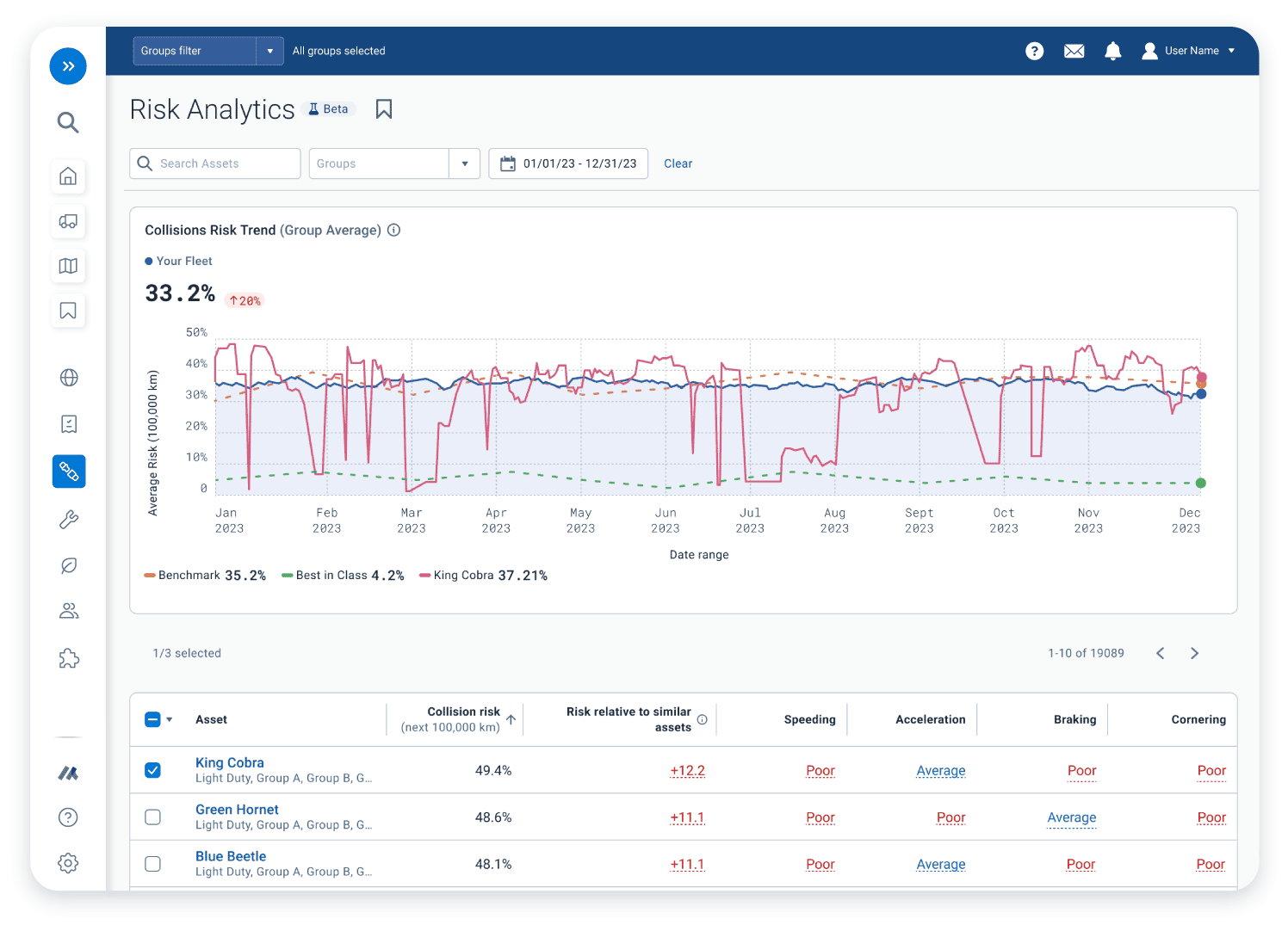
Delivery drivers face repeated stops, tight timelines, traffic congestion, parking challenges, and changing road conditions. Geotab driver safety tools help fleets monitor risky driving behavior, create custom safety rules, receive alerts, and use reports to support coaching. For fleets that need stronger visibility, Geotab GO Focus AI dash camera solutions can add real-time driver feedback and video-based context to help reduce risk and improve safety culture.
Keep Delivery Vehicles Road-Ready
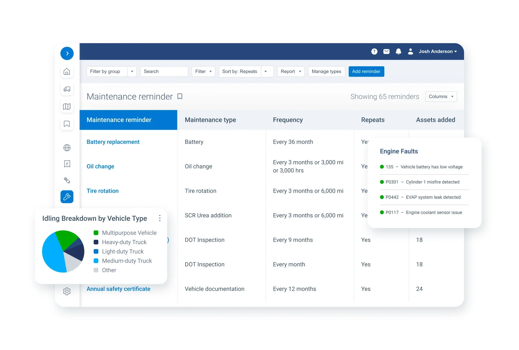
A vehicle breakdown can delay deliveries, frustrate customers, and disrupt the entire route schedule. Geotab vehicle health and maintenance tools help courier fleets monitor engine data, diagnostic trouble codes, faults, odometer readings, and service-related trends. This helps managers catch potential issues earlier, plan maintenance more effectively, and reduce avoidable downtime across delivery vans, cars, light trucks, and other fleet vehicles.
Support Proof of Delivery and Mobile Workflows
Courier and delivery companies often need more than vehicle tracking. Through the Geotab Marketplace, fleets can access integrated solutions for dispatching, mobile forms, job updates, delivery workflows, barcode scanning, photo capture, signatures, and proof of delivery. These tools can help connect drivers, dispatchers, and office teams so delivery records are easier to manage and service updates are easier to track.
Plan for Electric Delivery Vehicles
Many last-mile delivery fleets are exploring electric vehicles to reduce fuel costs and support sustainability goals. Geotab’s Electric Vehicle Suitability Assessment can analyze real fleet driving patterns, range needs, dwell times, charging options, and total cost of ownership to help identify which vehicles may be strong candidates for electrification. This gives courier and delivery businesses a more practical roadmap for adding EVs without guessing.

Build a Smarter Courier and Delivery Fleet
GPS Tracking America provides Geotab-integrated GPS tracking and fleet management solutions for courier and delivery businesses that want better visibility, safer drivers, stronger dispatching, and more efficient routes. From vehicle tracking and route optimization to maintenance insights, driver safety tools, Marketplace integrations, and EV planning, we can help you choose the right Geotab products and services for your operation. Contact us today to learn how GPS Tracking America can support your courier and delivery fleet.
What is GPS tracking for courier and delivery fleets?
GPS tracking for courier and delivery fleets uses connected vehicle devices and fleet management software to monitor vehicle locations, routes, drivers, stops, mileage, fuel use, maintenance needs, and delivery activity from one platform.
How can GPS Tracking America help courier and delivery companies?
GPS Tracking America provides Geotab-integrated solutions that help courier and delivery companies improve fleet visibility, optimize routes, monitor drivers, reduce delays, control costs, and make better operational decisions.
Why do courier and delivery fleets need GPS tracking?
Courier and delivery fleets need GPS tracking because vehicles are constantly moving between pickup points, delivery locations, warehouses, customer sites, and service areas. Real-time visibility helps managers know where vehicles are and how routes are progressing.
Can Geotab help improve delivery route planning?
Yes. Geotab solutions can help delivery fleets plan routes, monitor route progress, compare planned activity with actual vehicle movement, and identify opportunities to reduce unnecessary mileage and delays.
How does GPS tracking help with last-mile delivery?
GPS tracking helps last-mile delivery by giving dispatchers better visibility into vehicle location, stop activity, route status, and estimated arrival times. This can help improve scheduling, communication, and customer service.
Can Geotab help courier fleets reduce fuel costs?
Yes. Geotab fleet data can help managers monitor idling, fuel use, driving behavior, trip activity, and route efficiency. These insights can help identify fuel waste and support better cost-control decisions.
What types of courier and delivery vehicles can be tracked?
Geotab solutions can help track delivery vans, cargo vans, box trucks, service vehicles, cars, light-duty vehicles, and other fleet assets, depending on the device, installation, and business needs.
Can GPS tracking help dispatchers manage delivery changes?
Yes. Real-time location data helps dispatchers respond faster when routes change, customers request updates, drivers are delayed, or a vehicle needs to be reassigned to a nearby delivery.
How does Geotab support driver safety for delivery fleets?
Geotab can help monitor driving behavior such as speeding, harsh braking, rapid acceleration, cornering, seat belt use, and other safety-related events. Managers can use this data to coach drivers and support safer driving habits.
Can courier fleets use dash cameras with Geotab?
Yes. Courier and delivery fleets can use Geotab-compatible camera solutions, including AI dash camera options, to add video context, support driver coaching, and improve visibility into road events.
How can GPS tracking reduce delivery delays?
GPS tracking can help reduce delays by improving route visibility, identifying inefficient routes, helping dispatchers respond to issues faster, and giving managers better data on where time is being lost during the delivery day.
Can Geotab help with vehicle maintenance?
Yes. Geotab can help monitor vehicle health data, diagnostic trouble codes, odometer readings, engine faults, and maintenance trends. This helps courier fleets plan service and reduce unexpected downtime.
Why is maintenance tracking important for delivery fleets?
Maintenance tracking is important because delivery vehicles often operate on tight schedules with frequent stops. A breakdown can delay deliveries, affect customer service, and increase repair costs.
Can GPS tracking help reduce idling in delivery fleets?
Yes. Geotab reporting can show when and where vehicles are idling. Managers can use this information to reduce unnecessary engine use, lower fuel costs, and support more efficient fleet operations.
Does Geotab support proof of delivery workflows?
Geotab can support proof of delivery workflows through Marketplace integrations and partner solutions. Depending on the tools used, fleets may be able to manage digital forms, signatures, photos, barcode scanning, delivery records, and driver updates.
Can Geotab integrate with other delivery software?
Yes. Geotab Marketplace offers integrations and partner solutions that can connect fleet data with dispatching, routing, delivery management, mobile workforce, maintenance, and business reporting tools.
How can Geotab help managers understand fleet performance?
Geotab helps managers understand fleet performance through reports, dashboards, alerts, trip history, driver behavior data, fuel insights, maintenance information, and vehicle utilization trends.
Can Geotab help courier companies improve customer service?
Yes. Better vehicle visibility and route tracking can help courier companies provide more accurate updates, respond faster to delivery questions, reduce missed delivery windows, and improve overall service reliability.
Can delivery fleets use Geotab for electric vehicles?
Yes. Geotab provides tools that can help fleets monitor electric vehicles and evaluate which vehicles may be good candidates for electrification. This can help delivery fleets plan EV adoption more confidently.
How do I choose the right Geotab solution for my courier or delivery fleet?
The right Geotab solution depends on your fleet size, vehicle types, delivery routes, reporting needs, driver safety goals, maintenance requirements, and whether you need integrations such as dispatching, proof of delivery, or camera systems. GPS Tracking America can help you choose the best Geotab devices and services for your courier and delivery operation.