Geotab: Find Nearest Vehicle
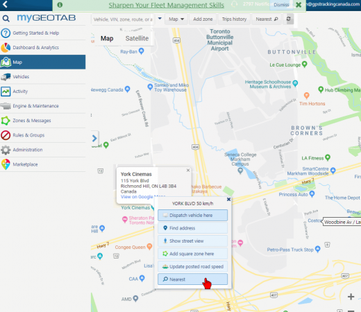
There is a feature that allows you to find the nearest vehicle in Geotab. It is a great feature to save travel time for the driver, expense on fuel and more.
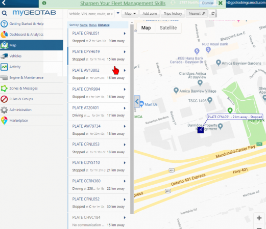
You simply click anywhere on the map and a menu will pop up with the location’s information. As soon as you select Nearest on the menu, the map will focus on the nearest vehicle and provide a distance from the clicked location and that vehicle. You can use this combined with daily traffic conditions that can be shown in the map to estimate how long it will take you drivers to reach that location.
You can also use the Dispatch vehicle here function so send your drivers the location you want to dispatch them to and they can receive it in the Geotab Drive mobile app and navigate from there. This is found within the same menu as Nearest.